We land in Christchurch and waste no time. We make our first of several stops at Kathmandu, the outdoor retailer whose quarter share will quadruple over the next couple of weeks, thanks to us. We make good time heading west through the center of the South Island along Route 73, despite the many one-lane bridges that might otherwise slow our progress. The landscape changes dramatically every 100 kilometres or so, yet it all seems so seamless, as if it's all apart of the same unbroken tapestry.
Our plan is to make it all the way to Hokitika on the west coast through the rugged and scenic Arthur's Pass. As we move past the arid fields of the Canterbury region and up higher in altitude, we become surrounded by hills of verdant green, accentuated by limestone rock formations that seem to have been scattered across the landscape by some unseen hand.


Our spirits high, we venture forward in anticipation of what would come next. Just as we approach what we assume would be the awe-inspiring view of Arthur's Pass, it seems, we suddenly find ourselves engulfed in a dense, endless cloud whose contents seemed hell-bent on replacing the world's fresh water supply all in one go. It is a portent of things to come.

We spend the night in Hokitika, a coastal town that seems to be more or less a collection of buildings that have been abandoned. The occasional glimpse of lamplight and the sound of music emanating from the odd dwelling reminds us that there are people still around. The rain has tapered off, but high winds send waves crashing violently to shore, and as we stroll along the beach we are perpetually belted with bullets of sand. We spend the night bundled in layers trying to ward off the cold air trapped inside our tent.

Day 2 & 3 - Franz Josef Glacier
We wake up to skies of grey above us. It's not long after we pack up our tent that the downpour resumes. We head south along Route 6, the windshield wipers working overtime to offer an occasional glimpse of the road ahead of us. Two hours later and we're in Franz Josef Glacier Village, home of the Franz Josef Glacier - currently obscured by clouds. With neither time nor the weather on our side, we decide to make a gamble and book a glacier tour for the next day, hoping that the skies will clear in time.
The gamble pays off, as later that evening the clouds begin to part, and as the first rays of sunshine peak through, multiple rainbows grace the stretch of the valley between the mountains and the shoreline. Our hopes remain high as we wake up to blue skies and the warm rays of the sun. As the hours of the morning tick by, however, I become increasingly nervous as one cloud after another begins to converge overhead. Before long, the mountains are once again concealed from view and the occasional sprinkling of rain suggests a preview of what is to come next.
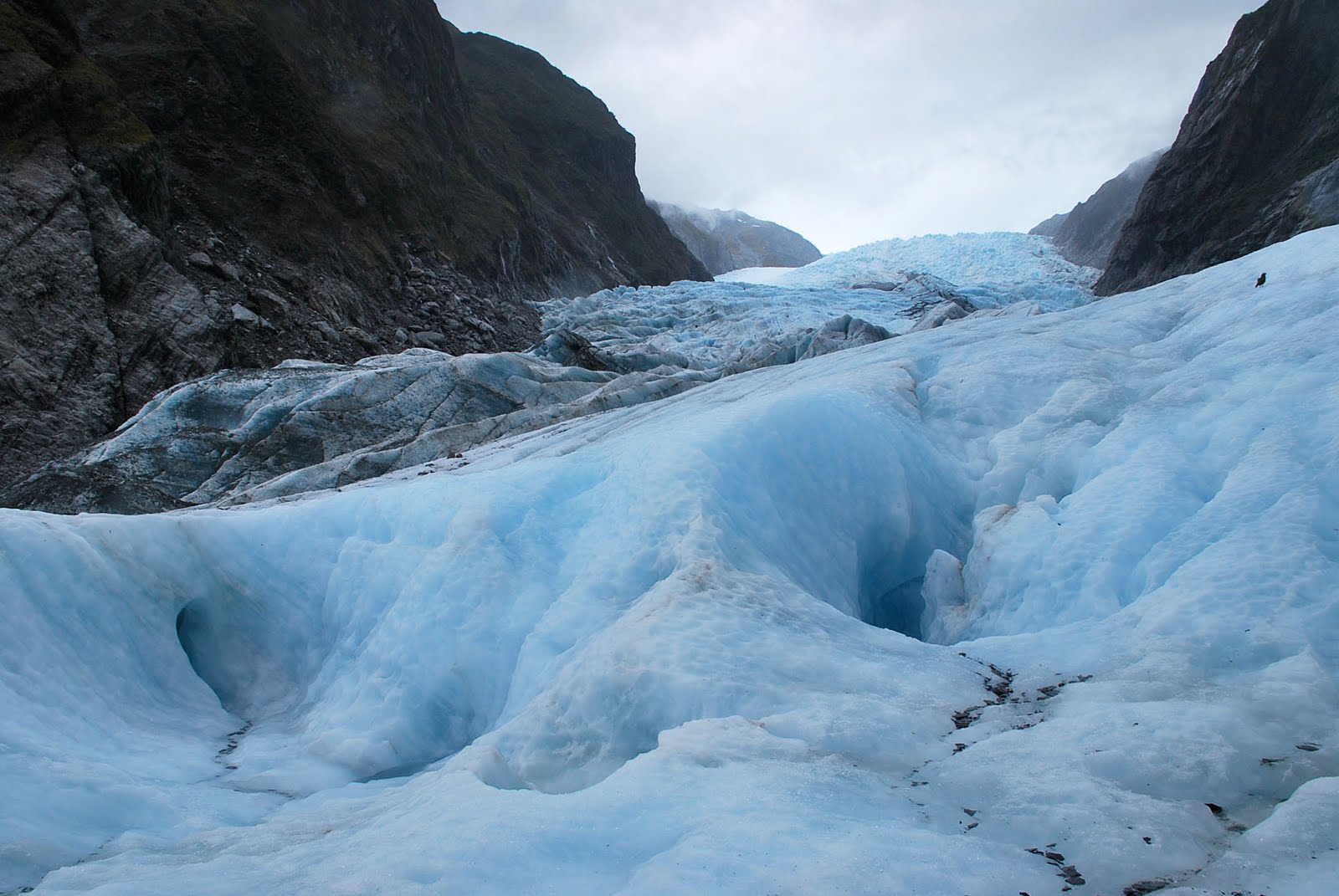
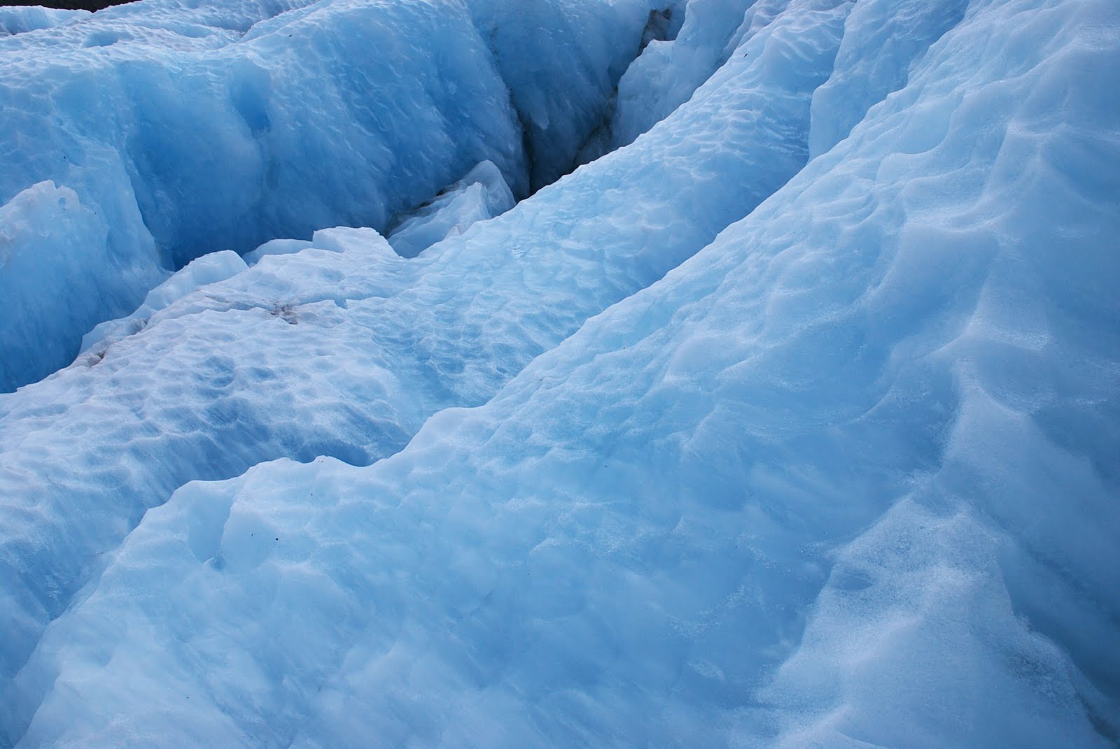
Curiously, the nexus of the coming storm seems to converge above the glacier itself, sparing the rest of the valley from another wet afternoon. Fitted with the necessary gear to hike the base of the glacier, we are shuttled by bus to the drop-off point a few kilometers from the glacier proper. A light drizzle followed by the occasional spurt of heavy rain accompanies our march through forest and along the rocky river bed formed by thousands of years of glacier movement. We strap crampons to our boots and are led up the icy surface of the glacier, where we marvel at its beauty, size and the impact that it has had in shaping the landscape around us. It's an incredible sensation to stand so firmly upon the ice, considering that I spent much of my childhood slipping on the icy sidewalk during winters on my way to school. It is quite possibly the first time I've spent any degree of time on the ice without bruising my ass.


Day 4 - The Road to Queenstown
The next morning we do our best to keep ourselves dry and warm as we pack up our belongings and extremely wet tent. The rain failed to cease throughout the night, and violent winds shook our tent with such force that it was hard to believe that it remained pinned to the ground. A few hours later, as we cross the Haast pass, however, the skies seemed to open up once more, offering up spectacular views of Lake Wanaka and Lake Hawea. With a string of jaw-dropping vistas, it was difficult not to stop at every single viewpoint along the way, but it was imperative that we make it to Queenstown in good time.


Once in Queenstown, we check in with the Department of Conservation to confirm our booking on the Routeburn Track. One of New Zealand's Great Walks, the three-day hike through some the South Island's most dramatic scenery is something that Laura and I both have been looking forward to for months since we first made our bookings. As Laura hands over the cash to pay for the track and hut fees, she asks the cashier about the weather conditions along the Routeburn for the next few days. The cashier looks up with a pained expression on her face: "Well..."
Day 5 - Queenstown
It's Christmas Day in Queenstown. Absolutely everything is closed, apart from a couple of coffee shops and a smattering of restaurants over-charging for Christmas Day set menus. We spend the early afternoon at our campground sampling bottles of champagne, beer and wine with a British couple we'd first met in Franz Josef. We are told of their misfortune on the drive to Queenstown, when the passenger door of the rental camper van unhinged itself completely from the body of the vehicle, resulting in their having to drive the next 70 kilometers or so hanging on to the door from the inside with all the force one person could muster. Some people have all the fun.
We end up paying $50 each to attend a Christmas Day party at the only pub open in town, where we feast upon a rubbery turkey buffet and teapots full of shooters. Forward planning was not on the menu that day.


Day 6 - Routeburn Track
A severe weather warning has been issued for Mount Aspiring National Park and Fiordland National Park, directly at the centre of which is the Routeburn Track. High winds and nearly 200mm of rain are expected over the next couple of days, not to mention frigid temperatures in the alpine region. As we leave Queenstown en route to the start of the track, our driver pulls over onto the side of the road to point out where the Routeburn Track is located in relation to the rest of the region. While there are blue skies and a bright morning sun above us, no more than 100 kilometers away is a swath of black clouds and fog that completely obscures our vision of the stunning mountainous terrain that should otherwise be clear to the eye. Incidentally, the driver points out, that's where the Routeburn Track begins.
Despite the weather warning, we only encounter a light but steady drizzle throughout the course of the 4-5 hour uphill trek. Most, if not all, of this part of the track is under the cover of the trees, which does afford us some protection from the elements. The going is slow - our hopes of getting in shape during the months leading up to the trip predictably failed to materialize. The weight of our backpacks, containing food, dishes, sleeping bags and clothes required for the three-day tramp place an extra burden on our bodies as we trudge upward in what feels like a never-ending ascent. The few Kiwis we encounter coming on their way down are all smiles and greet us with enthusiastic 'hellos.' I feel compelled to reply in the same manner, momentarily lifting my own spirits, regardless of the fact that my tone serves to disguise my true feelings. They're just so damn nice, those Kiwis. I'd hate to make them think that anyone could have a bad time hiking up a mountain in the rain.


The sight of the DOC hut at the end of the day incites a swell of hope in my heart. It's finally over - I can put my bag down. I can relax, put on some dry clothes, drink some tea. Life is good - for now.
Day 7 - Routeburn Track
My raincoat is falling apart. Bit by bit, the inner lining flakes off like a snake shedding skin. The wind and the rain are relentless. Once past the tree line, we are at the full mercy of the elements. Which, by the way, have no mercy. With countless days of rain behind it, the track has become muddy and slippery, and in most cases, the well-worn track has been replaced by small streams that follow the course of its path. This being the longest stretch of the hike, we spend about six or seven hours fighting off the chill and dampness that have long since seeped through our clothes and into our skin, all the while imagining what the landscape must really look like when you can actually see more than a few meters ahead of you.
There is a sense of unimaginable relief when we finally approach the tree line. We know the distance to the next hut can't be too far from here. The clouds and fog have long since erased everything from view, but through the mist I can barely make out the shape of Lake Mackenzie below us. Feeding into the lake are immense waterfalls that seem to descend from the heavens themselves. It's a breathtaking view, even if we can't see much of it.


Day 8 - Routeburn Track
Everything is cold. The temperatures were so low during the night, and without any heating in our cabin, all of our clothes from the past two days remain soaked, either from rain or from sweat. To make things worse, high winds have picked up in the valley, that coupled with the ubiquitous rain ensure that the four-hour trek to the next hut will be a cold and miserable one. My raincoat has ceased providing any protection from the elements, itself perpetually wet inside and out. By the time we stop for lunch at the last hut on the route, I'm a shivering mess. I just can't stop. There's no way for me to warm myself. All I want is for this to be done with.
As we resume our hike, thankfully, the rain begins to trickle, then disappear. Marching uphill once more, I generate more body heat and begin to feel more at ease (even if we do have to stop every few meters just to catch our breath). We reach the end of a trail and we both sigh a breath of relief. It's time to put on some dry clothes and huddle close together in wait for the bus. Almost simultaneously with its arrival, the clouds above us suddenly part, revealing a brilliant blue sky and that which been hidden from us for days. As we drive along the twisting roads back to Queenstown, we are taunted by the majestic beauty of the Fiordland. There is the sense that Nature herself is sticking her tongue out at us, as if to say, "Oh, I'm sorry. Was this what you were looking for?"


Day 9 -Milford Sound
The next morning, we wake up to more blue sky; one of the first days during the entire trip that this has happened. Knowing how quickly the weather can change, if we're going to see Milford Sound, it's got to be today. And now. While Laura packs up our gear, I race down to the booking office in Queenstown that handles the Milford Sound cruises. I book a spot for the two of us on the last cruise of the day. The clerk seems skeptical that we'll make it in time, but he doesn't take into consideration the fact that we're both so desperate to actually see some of the Fiordland that we'll do what it takes.
At speeds that should have defied the structural capabilities of our small, Toyota Corolla, we soared across the long, twisting roads that links Queenstown to Milford Sound, completing the 290 kilometer stretch of asphalt in less than 3 hours - an hour and a half less than it should normally take. As it is, we arrive just in time to make a couple of sandwiches and board the boat. Our efforts pay off in spades. We succeed, more or less, at racing the clouds to the coast, and while some peaks are shrouded from view, Milford Sound is as majestic as the travel brochures and Lord of the Rings have portrayed it to be.


Day 10 - The Road to Invercargill
The skies have returned to their uniformed grey. Once we've packed our tent amidst an onslaught of sandflies, we begin the day's journey to Invercargill on the southern tip of the island. Dramatic peaks give ways to lush green rolling hills, peppered with a smattering of sheep. We head along the Southern Scenic Route, which takes us along one tired town after the other. Boarded-up shops, abandoned homes and weeds poking through the sidewalks are a common feature, as if prosperity had long since packed his bags for more favorable opportunities elsewhere. Once the road meets with the coast, we are met by fierce winds from the sea, making it difficult to keep the car steady. Along the coast, trees are bent forward, their branches reaching out like arms to maintain their balance from the relentless beating from the offshore gales.


We arrive in Invercargill in the early evening. The winds rage unabated, making the deserted streets of Invercargill seem even more chilling and eerie than the absence of people alread. Like many of the other towns we had passed through during our journey south, the glory days of the city's past seemed to have long since gone. Wide boulevards and buildings of historic grandeur, signal the original city planner's hopes for the its prosperity and prominence in the region. However, little could hide the sense of decay that seems to have firmly gripped the city's buildings and thoroughfares. It certainly was not somewhere we planned to stay for long.


Day 11 - Stewart Island
We get up early to catch the ferry from Bluff to Stewart Island. A light drizzle has arrived to accompany the violent winds that have yet to cease since we arrived on the south coast. The hour-long ferry ride to the island is a strength of stamina and intestinal fortitude, as giant swells force the craft into the air, causing it to crash down on top of oncoming waves. Again and again. By the time we dock in Oban, the island's only large settlement, it is pouring rain. By the time we've made the 300m dash to the campground, everything on us is drenched, including our bags.
We check in and leave our things to dry in the common room/kitchen. We return through the rain to the center of town, which consists of a school, a small hotel and bar, a grocery store and the large pier from which we had docked. A smattering of homes stretch in either direction along the bluffs that form the coastline, as well as further inland. With only 400 residents on the island, most of them in Oban, there is a sense of real tranquility as no one is in a rush to get anywhere.
Once the rains cease in the late afternoon, we walk along the coast straining our eyes to spot a penguin.


Day 12 - Stewart Island
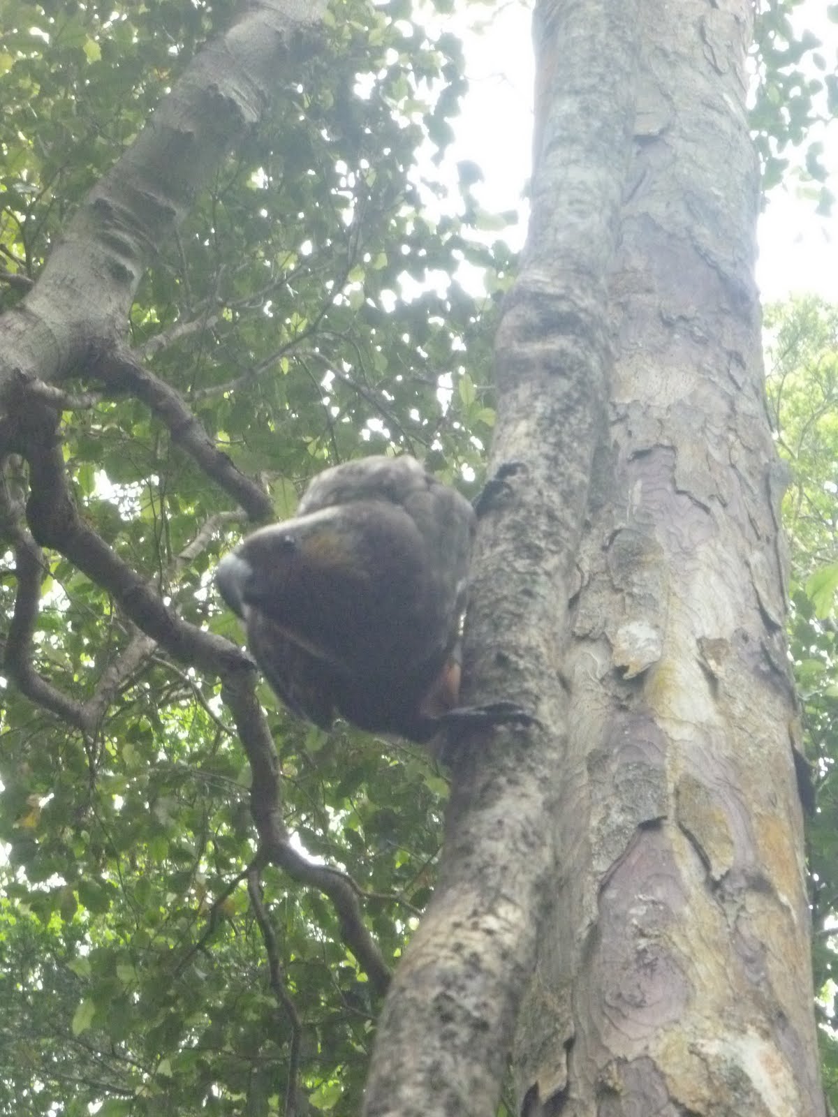
With roughly 80 percent of the island under the protection of the New Zealand government, conservation of native bird and plant life is a key facet of Stewart Island. With the introduction of pests such as possums and rats in other parts of New Zealand, much of its wildlife has been placed at serious risk. We visit Ulva Island, roughly half-an-hour from Oban, where conservationists have been successful in trapping and eliminating all pests from the island, making it a haven for New Zealand's native birds. With several endangered species introduced to the island, we scour the forest for signs of life. We don't have to wait long, for the birds seem to be just as interested in us as we are of them. Just by standing still, the birds come to us, some following us along in hopes that our boots will unearth tasty treats from the upturned soil. With our binoculars and guidebook in hand, we spot a vast array of birds whose songs and dramatic flights through the forest keep us spell-bound for hours.
Inspired by our day's bird-spotting success, we take off after sunset in search of the most elusive New Zealand bird of all: the Kiwi. Nocturnal and flightless, the Kiwi is renowned for its shyness. We decide to park ourselves in a field by the edge of a forest, where a road sign warning drivers to keep an eye out for the bird at night seems like a good enough beacon from where we might spot the animal. We spend half-an-hour sitting in the dark, but with nothing more than what seems like a frog's mating call, we seem to be alone. We return to camp, having failed in our mission.


Day 13 - Stewart Island to the Catlins
We learn that the only ferry we can board won't be until the late afternoon, which means that we'll have to keep ourselves preoccupied until then. We do a day hike around Halfmoon Bay, admiring the untouched coastline and beaches that form the landscape. We finish off our day's workout with a helping of deep-fried mussels and chips at the Kai Kart. Any food that's cooked in a trailer is guaranteed to be good.
I remain silent and my gaze stays fixed upon the horizon line as we once again cross the channel between the two islands. Perhaps those mussels weren't such a great idea. A minute more and I would have seen them for the second time.
We make it as far as Curio Bay in the Catlins by dusk. There is another failed attempt to spot penguins or dolphins - animals that the region is famous for being able to spot.


Day 14 - Dunedin
It's late afternoon when we arrive in Dunedin, home to the Speight's brewery and the Dunedin train station, which boasts itself as being the second most photographed building in the Southern Hemisphere (right behind the Sydney Opera House, natch). Both of these buildings I fail to photograph myself.
What is a success, however, is our goal to spot a penguin. We spot several, in fact. Of course, we had to pay for it - through the nose. At Penguin Place on the Otago Peninsula, we are afforded the opportunity to spot the rare yellow-eyed penguin in its natural habitat - up close and personal. The project was spawned by a farmer whose land had long been used as a breeding place for the penguin, but due to deforestation, the penguin's very survival was at risk due to the loss of habitat. The farmer's family embarked upon a project to conserve the area along the coast and re-plant native vegetation to provide protection for the animal as well as a place for them to breed. As part of this project, they dug out trenches throughout the area that allows visitors to get right up close to the penguins' nests that would otherwise be concealed and impossible to reach without startling them. We timed our visit for the right time of day, as the adult penguins were returning home from a day at sea and to feed their babies, which were about seven weeks old at the time.

Day 15 - Dunedin
We spend the day playing tourists in Dunedin. We're joined by Laura's colleague Teresa, who leads us around some of the must-see sights the city has to offer. This includes the Cadbury chocolate factory, where we are treated to the sight of one-ton of melted chocolate being dumped from a steel cauldron at the top of a silo for no other purpose but for our pleasure. We also ate lots of chocolate.
Our next stop is Baldwin Street, the tallest street in the world! We walk up the steep slope of the street, thereby earning a pat on the back from each other. We make a quick stop at the souvenir shop at the base of the road, where we learn by pressing a button on plush Kiwi that the frog-like call we'd heard on Stewart Island was in fact a Kiwi-call! How many people can claim they've heard that?!
We then head out to the Otago Peninsula once more to the Albatross sanctuary, the only one of its kind on the mainland. From this vantage point, we observe these incredible seabirds coast along the winds around the spit of the peninsula, their wingspans casting immense shadows upon the land below.


Day 16 - Otago Trail
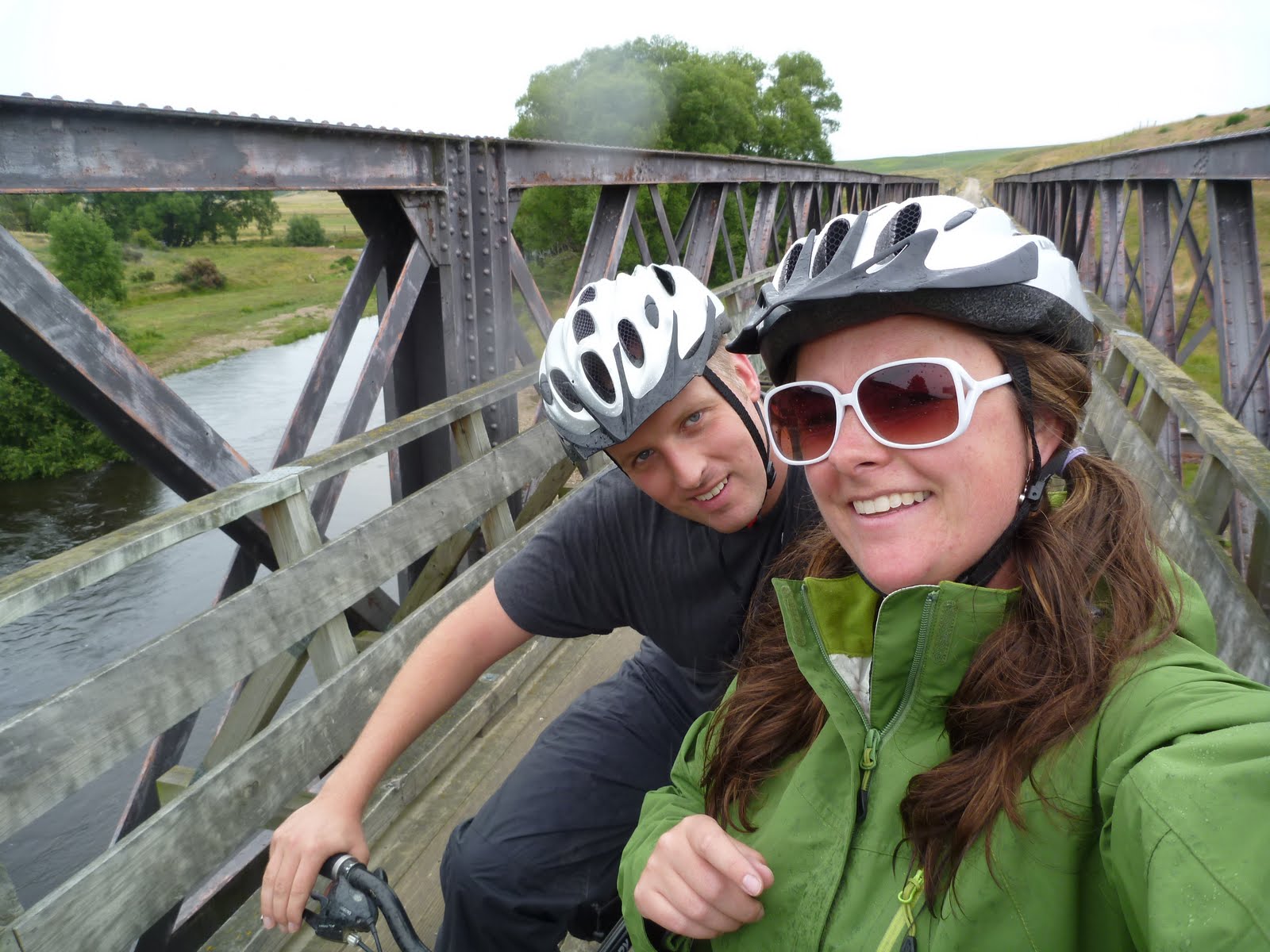
We leave Dunedin early the next morning for Middlemarch, a small village which serves as the start and end point for the Otago Rail Trail. The Rail Trail is a bike route that follows the route of the former Otago Railroad, which had once connected the small towns and settlements in the Otago region before the advent of roads and automobiles. And since it's a multi-day, outdoor adventure, it begins to rain the moment we set out.
From Middlemarch, we are driven to the small, rural town of Ranfurley (incidentally the Art Deco capital of New Zealand). Resigned to the fact that there was nothing we would do on this trip that didn't involve us getting wet, we throw on our raincoats and pants and begin pedaling down the gravel track as dark clouds loom over the horizon. The overcast skies and light drizzle actually work in our favor, as it helps to cool us down as we cycled the 38 kilometer distance between Ranfurley and Hyde, which is where we had arranged to stay for the night.
When we arrive in Hyde, a small outpost that consisted of a hotel and cafe and not much else, we are treated to deluxe accommodation for our standards, which basically means that we get to sleep on a bed and don't have to crawl out of a tent in the middle of the night to use the toilet. Out of all the guests staying at the small hotel, we are the only ones below the age of 45. The topic of conversation at the dinner table is, naturally, us, and what exciting lives we must lead living in a place like Singapore. That's in China, right?


Day 17 - Otago Trail
Despite the blue skies and sunshine that had graced us the evening before, storm clouds have once again blanketed the skies above the Otago plains, and the rains have made the track a muddy mess. Resolved to just get things over with, we slowly trudge through the torrential rain and sludge, emerging at the end of the track cold, miserable and beaten. By this point, I feel done with the trip. I admit defeat. I just want to go home.


Day 18 - Akaroa
We spend the night in Timaru, halfway between Dunedin and Christchurch. Traveling throughout the day, we reach the small town of Akaroa on the Banks Peninsula, just south of Christchurch. From an aerial view, the Banks Peninsula reveals itself to be a massive crater formed by a extinct volcano, and as we descend from the top of the rim down into the crater-formed valley below, I am amazed at the rugged and spectacular beauty of the region. If this is how I have to spend my last couple of days in New Zealand, then that's fine by me.
Originally a town that had been settled by the French before the Treaty of Waitangi, it still retains a certain French flavour; most notably in the use of the article 'le' at the beginning of a shop's name. It's the kind of town my mom would like. The one with lots of boutique shops and little cafes, a boardwalk and its signature lighthouse. It's the kind of town my dad would like too - there were lots of benches to sit on while waiting.
But what we were looking forward to was the chance to do some paddling - to get out and explore beyond the harbour that eventually opened out to the sea, and that was famous for its schools of dolphins who graced the waters nearly year round.


Day 19 - Akaroa
The next day, it rains. Heavily. Not to forget the winds, which have forced the kayak rental shop to close its doors for the day. We spend the afternoon in the Akaroa cinema, having decided to catch a recent Kiwi release as it is so rarely seen: on the big screen. There's a reason for that, apparently. It was horrible, and the place served no popcorn to boot. The experience did nothing to brighten my spirits.
By the time we've exited the cinema, the sun is shining once more, but the winds are still unrelenting. We decide to take a drive to some of the outlying villages and explore some of the beaches whose waters, naturally, are too cold for us to swim.

Day 20 - Akaroa to Christchurch
Summer has returned to New Zealand at last. It's hot, it's sunny, and for once our outdoor pursuits are unhampered by the elements. Once we've strapped ourselves into a kayak, we paddle steadily out of the harbour and into the inlet that lead to the sea. Overcome with anticipation at spotting a dolphin, our eyes begin playing tricks on us, making us think that every piece of driftwood or seaweed might possible be what we hope it might be. We paddle further and further out, keeping an eye on the dolphin-spotting cruise boats that speed by with a shared objective in mind. But as the boats circle back and forth and finally head further out to sea in search of their goal, we realize that our prospects have diminished. For whatever reason, the dolphins have decided not to play in the inlet that morning, like they have every morning for the past two thousand years. We're saddened at the prospect of not experiencing a close encounter with these amazing mammals, I'm nonetheless satisfied that we actually got to do something. Period.

We return to Christchurch that afternoon, just in time for Laura to hit the Sunday market. I attempt to do some shopping of my own, searching out the comic book shop I'd visited the last time I was there. Navigating the city's streets is a lot more difficult than I remember. Roadwork and re-construction projects that began after the September earthquake mean countless detours throughout the city's core. When I finally arrive at the shop, which is of course closed, I'm shocked to discover what remains of the street that I had walked along just a year ago. The section of the street just meters away from the shop is fenced off, and the buildings beyond are nothing more than rubble and debris. The street is desolate and eerily silent, painting a foreboding picture of the fate that awaits this city.

3 comments:
All I can say is W O W !
You have done a fabulous job of letting us share your trip and not get wet and cold.
We felt your pain! Great job buddy - even with that little comment about your parents!
I knew there was a reason I'd seen no reply from you, Colleen's Renos! Time to update your blog with photos of your trip!
Post a Comment